
Kini Stream Restoration Project
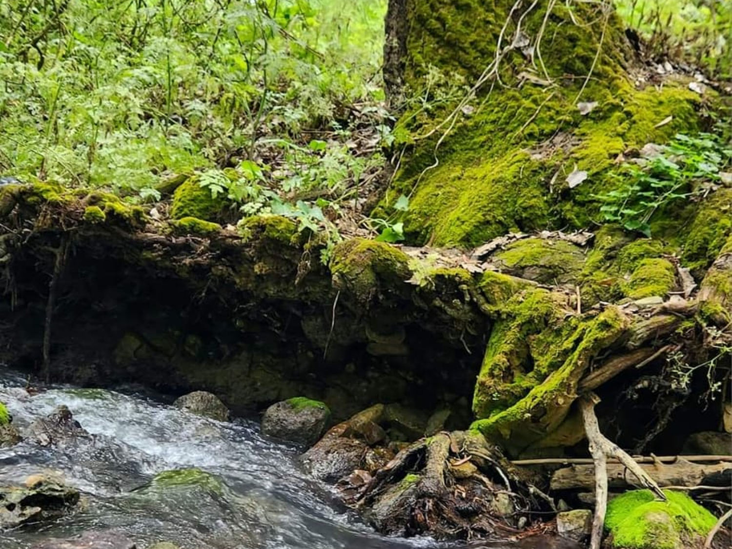
שיקום המקטע העליון של נחל הקיני
פרויקט שיקום נחל הקיני נשען על תפיסה אגנית רחבה, שמטרתה ליצור מערכת נחלית רציפה ומתפקדת -מהמעיינות במעלה הנחל ועד לחיבורו עם שפך הקישון. בשנת 2020 הוכנה תוכנית אגנית כוללת לכל מרחב נחל הקיני ואגן הניקוז שלו, באמצעות צוות בין־תחומי שכלל אקולוגים, הידרולוגים, אנשי תכנון ונוף, ובשיתוף רשות הטבע והגנים, קק"ל, רשות המים, המועצות האזוריות הרלוונטיות וגורמים מקצועיים וציבוריים נוספים. במסגרת התוכנית בוצע סקר מקיף של כלל האגן, זוהו מוקדי הפגיעה והאתגרים המרכזיים, והנחל ויובליו חולקו לכ־20 מקטעים בעלי מאפיינים מורפולוגיים, הידרולוגיים, אקולוגיים ונופיים שונים. לכל מקטע הוכן ניתוח של המצב הקיים, הוגדרו אתגרים מרכזיים, גובשו המלצות ומהלכי תכנון מועדפים, ונקבעו סדרי עדיפויות ואומדני תקציב. מתוך כלל המקטעים נבחרו מקטעים 5 ו־6, באזור המעיינות ובקטע האיתן של הנחל, כמקטעים הראשונים לקידום לתכנון מפורט ולביצוע.
השיקום במקטעים אלה נועד להשיב לנחל את תפקודו ההידרולוגי, האקולוגי והנופי לאחר עשרות שנים של פגיעה מצטברת. לאורך השנים הושפע הנחל משאיבת מים, הקמת מתקנים הנדסיים ששינו את מהלך הזרימה וחסמו את רציפות האפיק, רעיית בקר אינטנסיבית, תנועת כלי רכב וטרקטורונים בתוך ערוץ הנחל, ריבוי דרכי עפר, חציות נחל, הצטברות פסולת ונטיעות של מיני עצים שאינם מקומיים ואינם מותאמים לבית הגידול הנחלי.
אחד המהלכים המרכזיים בפרויקט היה הסדרת משטר המים. בשיתוף רשות המים, רשות הניקוז ורשות הטבע והגנים נמצא מקור מים חלופי לצרכים החקלאיים של קיבוץ מגידו וקיבוץ גבעת עוז, מה שאפשר להפסיק את השאיבה הישירה מהנחל. בעקבות זאת פורקו מתקן השאיבה ומאגר הגיא, אשר היוו במשך שנים חסמים משמעותיים לזרימת מים, למעבר סדימנטים ולרציפות האקולוגית. הסרתם אפשרה להשיב זרימה רציפה יותר בנחל, לשפר את משטר הזרימה ולהחזיר לנחל חלק ממאפייניו כנחל איתן.
במקטעים שבהם המתקנים ההנדסיים שינו או העלימו את תוואי הנחל בוצע שיקום מורפולוגי מקיף. האפיק עוצב מחדש תוך יצירת שיפועים מתונים, מיתון גדות, ייצוב הקרקע באמצעים טבעיים ושימוש בבולדרים, אבן וחומרי קרקע. באזור מאגר הגיא נערך גם מחקר היסטורי לצורך איתור תוואי האפיק המקורי, והוא נחפר מחדש. בנוסף הוקם גשר חקלאי המאפשר מעבר כלי רכב ללא חצייה ישירה של המים וללא פגיעה ברציפות הנחל.
במקביל בוצעה הסדרה נרחבת של תנועת כלי רכב במרחב. לאורך כ־10 ק"מ הוצבו חסימות, בולדרים ושערים, בוטלו וטושטשו דרכים לא מוסדרות, וצומצמה באופן משמעותי הכניסה של כלי רכב וטרקטורונים לערוץ הנחל. מהלך זה נועד להפחית הפרעה, סחיפה ופגיעה בבתי הגידול ולאפשר לנחל להתאושש באופן טבעי.
מרכיב נוסף בפרויקט היה שיקום הצומח. בוצע דילול משמעותי של עצי אקליפטוס המקור וברוש מצוי במקטעים רגישים, תוך שמירה על פרטים בוגרים ובעלי ערך נופי ומורשתי. מטרת הדילול הייתה לפתוח את חופת היער, להכניס אור, לצמצם את השפעתם של מינים זרים ולאפשר התבססות מחודשת של צמחייה מקומית. במקביל גובשה תוכנית נטיעות הכוללת מאות עצים ושיחים מקומיים האופייניים לבתי גידול של נחלים, וכן זריעה של מיני בר בשטחים שעברו עבודות עפר.
הפרויקט כלל גם שימוש בפתרונות מבוססי טבע לצורך השהיית נגר, מיתון עוצמות הזרימה והרחבת פשט ההצפה. בין היתר תוכננו סכרונים "נושמים" מבולי עץ, עיצוב מחדש של חלקים מהקרקע ומיתון גדות באמצעות אמצעים רכים, ללא הסתמכות על קירות בטון או פתרונות הנדסיים קשיחים.
לצד ההיבטים הפיזיים והאקולוגיים ניתן בפרויקט דגש גם לשימור ערכי מורשת ועתיקות, ובהם שרידים של מתקני מים היסטוריים וטחנות קמח שפעלו לאורך הנחל. התכנון נדרש לאזן בין הצורך בשיקום המערכת הטבעית לבין שימור, חיזוק והנגשה של מרכיבים היסטוריים משמעותיים.
בנוסף שולבו פעילויות קהילתיות וחינוכיות, ובהן ימי ניקיון עם תנועות נוער, פעילות של תלמידי בתי ספר והיכרות מחודשת של הקהילה המקומית עם הנחל. במקביל גובשה תפיסה לחיבור הנחל למרחב המסחרי הסמוך ולמערך התיירות האזורי, מתוך מטרה לחזק את הנגישות, להרחיב את קהלי היעד וליצור תרומה גם לכלכלה המקומית.
בסיכומו של דבר, פרויקט המקטע העליון של נחל הקיני הוא יישום ראשון של התוכנית האגנית הכוללת, והוא מהווה שלב יסוד במהלך ארוך טווח לשיקום הנחל כולו. הפרויקט שילב טיפול במקורות הפגיעה עצמם עם שיקום הידרולוגי, מורפולוגי, אקולוגי, נופי, קהילתי ותיירותי. הצלחת ההתערבות במקטעים 5 ו־6 מהווה כיום בסיס להרחבת עבודות השיקום למקטעי המורד, בין כביש 66 לנחל הקישון, במטרה להמשיך ולבסס רציפות הידרולוגית, אקולוגית ונופית לאורך המערכת כולה.
Restoration of the Upper Section of the Kini Stream
The Kini Stream restoration project is based on a broad, basin-wide approach aimed at creating a continuous, functional stream system—extending from the headwaters upstream to the confluence with the Kishon estuary. In 2020, a comprehensive basin-wide plan was prepared for the entire Nahal Kini area and its drainage basin. This effort involved an interdisciplinary team—including ecologists, hydrologists, and landscape planners—and was conducted in collaboration with the Nature and Parks Authority, KKL-JNF, the Water Authority, relevant regional councils, and other professional and public stakeholders. As part of the plan, a comprehensive survey of the entire basin was carried out, key areas of degradation and major challenges were identified, and the stream and its tributaries were divided into approximately 20 segments, each with distinct morphological, hydrological, ecological, and landscape characteristics. For each segment, an analysis of the existing situation was prepared, key challenges were defined, recommendations and preferred planning strategies were formulated, and priorities and budget estimates were established. From among all the segments, Segments 5 and 6—located in the springs area and the perennial section of the stream—were selected as the first to advance to detailed planning and implementation.
The restoration of these segments aims to restore the stream's hydrological, ecological, and landscape functions following decades of cumulative degradation. Over the years, the stream has been impacted by water extraction; the construction of engineering structures that altered flow patterns and obstructed the continuity of the channel; intensive cattle grazing; and the movement of vehicles and ATVs within the stream channel. ...proliferation of dirt roads, stream crossings, waste accumulation, and the planting of non-native tree species unsuited to the riparian habitat.
One of the project's key initiatives was regulating the water regime. In collaboration with the Water Authority, the Drainage Authority, and the Nature and Parks Authority, an alternative water source was secured for the agricultural needs of Kibbutz Megiddo and Kibbutz Givat Oz, enabling the cessation of direct pumping from the stream. Consequently, the pumping facility and the HaGai Reservoir—which for years had posed significant barriers to water flow, sediment transport, and ecological continuity—were dismantled. Their removal facilitated a more continuous flow, improved flow dynamics, and restored some of the stream's characteristics as a perennial watercourse.
In sections where engineering structures had altered or obliterated the stream's original course, comprehensive morphological restoration was carried out. The channel was re-contoured to create gentle slopes and banks, with soil stabilization achieved through natural methods and the use of boulders, stone, and earth materials. Historical research was conducted in the HaGai Reservoir area to identify the original channel alignment, which was then re-excavated. Additionally, an agricultural bridge was constructed to allow vehicle passage without direct water crossings or disruption to the stream's continuity.
Simultaneously, regulation measures were implemented... ...extensive vehicle movement in the area. Roadblocks, boulders, and gates were installed along a stretch of approximately 10 kilometers; unauthorized tracks were removed or obscured; and vehicle and ATV access to the stream channel was significantly restricted. This initiative aimed to reduce disturbance, erosion, and damage to habitats, allowing the stream to recover naturally.
Another component of the project was vegetation restoration. Significant thinning of River Red Gum (*Eucalyptus camaldulensis*) and Mediterranean Cypress (*Cupressus sempervirens*) was carried out in sensitive sections, while preserving mature specimens of scenic and heritage value. The thinning aimed to open the forest canopy, admit light, reduce the impact of non-native species, and enable the re-establishment of native vegetation. Concurrently, a planting plan was developed featuring hundreds of native trees and shrubs typical of riparian habitats, alongside the sowing of wild plant species in areas where earthworks had taken place.
The project also incorporated nature-based solutions to delay runoff, moderate flow intensity, and expand the floodplain. Measures included the design of "breathing" check dams made of logs, land contouring, and bank stabilization using "soft" techniques—avoiding reliance on concrete walls or rigid engineering structures. Alongside physical and ecological aspects, the project emphasizes the preservation of heritage values and antiquities, including the remains of historical waterworks and flour mills that once operated along the stream. The planning process sought to strike a balance between restoring the natural ecosystem and preserving, reinforcing, and providing access to significant historical features.
In addition, community and educational activities were incorporated—such as cleanup days involving youth movements and school groups, and initiatives to reconnect the local community with the stream. Concurrently, a strategy was developed to link the stream to the adjacent commercial area and the regional tourism network, aiming to improve accessibility, broaden the visitor base, and boost the local economy.
Ultimately, the project focusing on the upper section of the Kini Stream represents the first implementation of the comprehensive basin-wide plan and serves as a foundational step in the long-term effort to restore the entire stream. The project combined addressing the actual sources of degradation with hydrological, morphological, ecological, landscape, community, and tourism-related restoration. The success of the intervention in segments 5 and 6 now serves as a basis for extending restoration work to the downstream segments—between Route 66 and the Kishon Stream—with the aim of further establishing hydrological, ecological, and landscape continuity throughout the entire system.